
Start with the most important thing this page can tell you: no sanctioned plan and no master-plan drawing has been published for this project. There is no released site layout, no tower-numbering key, no block-spacing diagram and no landscape drawing in the public record. What exists is a building programme described in words inside two filings — how many buildings, how many towers, how many homes in each, how many floors, and how much land and built-up area the promoter has declared. That is a real and unusually specific skeleton. It is not a master plan, and this page will not dress it up as one. From a planning angle, Embassy South Reserve keeps the reference local: internal roads, open-space placement, amenity access, and tower orientation all affect how the address will live after handover.
The land: what the Navaratna Agrahara filings actually declare
The current filing is an application for environmental clearance, still open.
| Field | Filed value |
|---|---|
| Status | Under Examination, filed 03/08/2026 |
| Land | 6.80 hectares = 16.80 acres |
| Plot area | 68,012.5 sq m |
| Built-up area | 262,029.83 sq m |
| Project cost | Rs 564 crore |
| Village | Navarathna Agrahara Village, Jala Hobli, Yelahanka Taluk, Bangalore 562 157 |
| Promoter | Embassy Developments Limited |
The address to use for this site is MS Engineering College Road, Navarathna Agrahara, Jala Hobli, Yelahanka Taluk, Bengaluru 562157. The land sits on the North Bengaluru airport corridor. M S Engineering College — the institution the road is named for — is 0.90 km away by road, and Navrathna Agrahara Lake is 0.99 km by road.
The parcel is assembled from twenty survey numbers: 124(P), 129(P), 131(P), 132(P), 134(P), 136(P), 137(P), 138(P), 139(P), 140(P), 141(P), 142(P), 143(P), 144, 145(P), 146, 147, 148, 149(P), 150(P). The "(P)" marks a part-survey holding. Sixteen of the twenty are partial, which is what you would expect of an assembly stitched together from adjoining agricultural holdings rather than a single clean plot.
Two internal checks on the land figures, both our own arithmetic. First, 6.80 hectares is 68,000 sq m, and the separately filed plot area is 68,012.5 sq m — the two agree to within 12.5 sq m, so they are the same parcel stated twice, not two different measurements. Second, 68,012.5 ÷ 4,046.86 sq m per acre = 16.807 acres, which is the 16.80-acre figure. The land number is internally consistent.
What changed between the granted ToR and the pending clearance application
An earlier filing on the same parcel, by the same promoter, reached a milestone the current one has not.
| Field | Earlier filing | Current filing |
|---|---|---|
| Status | Standard Terms of Reference granted 04/05/2026 by the state environmental authority | Under Examination, filed 03/08/2026 |
| Land | 6.45 ha (15.94 acres) | 6.80 ha (16.80 acres) |
| Built-up area | 261,294.83 sq m | 262,029.83 sq m |
Three differences are worth stating precisely, and no more than precisely. The filed land area rises from 6.45 to 6.80 hectares — an increase of 0.35 ha, about 0.86 acres. The filed built-up area rises by exactly 735 sq m, which is a rounding-scale change against a quarter of a million square metres. And the signed Terms of Reference certificate prints a sixteen-number survey list where the current record prints twenty: the certificate omits 129, 131, 132 and 134, and prints "150" where the current list prints "150(P)".
It is tempting to join those facts into a story — that the four extra survey numbers are the extra 0.35 hectares. Do not read it that way, and we will not write it that way. No record states an area against any individual survey number, and survey 150 moved from full to partial between the two documents, a change that subtracts land rather than adding it. The honest statement is the flat one: the later filing lists four survey numbers the certificate does not, and the filed land area rises from 6.45 to 6.80 hectares. Nothing in the public record explains the relationship between those two facts.
No environmental clearance has been granted for this site. A Standard Terms of Reference was issued on the earlier, now superseded, filing — that is permission to carry out the studies, not permission to build. The clearance application itself remains under examination.
The building programme: eight towers, a clubhouse and two low-rise blocks
Both filings describe the same programme, and this is the part of the record that is genuinely detailed.
| Building | Contents | Configuration |
|---|---|---|
| Building 1 | Towers 1–5, 838 flats | 3B + G + 14UF up to 3B + G + 20UF |
| Building 2 | Towers 6–8, 466 flats | 3B + G + 14UF up to 3B + G + 20UF |
| Building 3 | Clubhouse | 2B + G + 3UF |
| Buildings 4 and 5 | 48 villaments | 2B + G + 3UF |
That totals 1,304 apartments and 48 villaments — 1,352 homes across eight towers and two low-rise blocks, with a standalone clubhouse building. The 48 villaments are low-rise units and are not apartments; anyone applying the 1,352 figure to the apartments alone has merged two different products.
The eight-tower count deserves a note of its own. Tower counts are usually the softest number in Indian pre-launch material, invented by whoever wrote the brochure. Here it is stated inside a regulatory filing, split across two named building groups with flat counts against each. Treat it as solid.
The floor notation reads as follows. 3B + G + 14UF means three basement levels, a ground floor, and fourteen upper floors. 3B + G + 20UF is the tallest permitted variant in the declared range — three basements, ground, and twenty upper floors. The filing gives the range and nothing finer: it does not state a floor count for any individual tower, so no tower on this site can be described as tall or short on the strength of the public record. The clubhouse and the two villament blocks sit at 2B + G + 3UF — two basements, ground and three upper floors.
Three points follow from that notation and are worth a buyer's attention. Three basement levels under eight towers is a substantial excavation, and basements at this scale ordinarily carry parking and services. The clubhouse having its own two basement levels tells you it is a genuine standalone building with its own servicing, not a few rooms carved out of a tower podium. And a spread of fourteen to twenty upper floors across eight towers means the skyline is not uniform — some blocks will be materially taller than others, though no document says which.
Density on 16.80 acres: our own arithmetic, shown
Everything in this section is our derivation from the verified figures above. It is arithmetic, not a claim by the developer, and each line shows its working.
| Derived measure | Working | Result |
|---|---|---|
| Homes per acre | 1,352 ÷ 16.80 | about 80.5 homes per acre |
| Apartments per acre | 1,304 ÷ 16.80 | about 77.6 apartments per acre |
| Homes per hectare | 1,352 ÷ 6.80 | about 198.8 homes per hectare |
| Land per home | 68,012.5 sq m ÷ 1,352 | about 50.3 sq m (about 542 sq ft) of site per home |
| Built-up area in square feet | 262,029.83 × 10.7639 | about 2.82 million sq ft |
| Ratio of built-up to plot area | 262,029.83 ÷ 68,012.5 | about 3.85 |
| Average flats per tower | 1,304 ÷ 8 | 163 |
| Average, Towers 1–5 | 838 ÷ 5 | about 168 |
| Average, Towers 6–8 | 466 ÷ 3 | about 155 |
Read those with the right caveats. About 80 homes per acre is a high-rise urban density — not a plotted or villa density, and not a low-rise garden scheme. The land-per-home figure of roughly 50 sq m is the same fact stated in a way that is easier to picture: for every home on the site there is about fifty square metres of ground, and the buildings, roads, parking ramps, clubhouse and every square metre of landscape must all come out of that.
The 3.85 ratio is not a sanctioned Floor Area Ratio and must not be quoted as one. The built-up area declared in an environmental filing conventionally includes basements, parking decks, service areas and common circulation, most of which is excluded when FAR is computed. The real sanctioned FAR is whatever BIAAPA approved, and that number has not been published. For the same reason, 2.82 million sq ft is not saleable area — dividing it by 1,352 to get an average home size would produce about 193.8 sq m (roughly 2,086 sq ft) per home, and that figure would be badly wrong as a unit size, because it silently attributes every basement bay, corridor and clubhouse floor to somebody's flat. We show the number only to kill the temptation to use it.
The per-tower averages are averages. The filing allocates 838 flats to five towers and 466 to three; it does not allocate flats to individual towers, so no single tower's count can be stated.
One further band, offered as an estimate with its assumption named. If the eight towers span fourteen to twenty upper floors, and if the ground floor of each is also an occupied residential level, then 1,304 flats across 8 × 21 levels gives about 7.8 flats per floor at the tall end, and across 8 × 15 levels gives about 10.9 flats per floor at the short end. So the towers are plausibly in the eight-to-eleven-homes-per-floor range — the kind of layout served by two or three lift cores per floor plate rather than a long double-loaded corridor. The ground floor may well be parking or amenity rather than housing, in which case the true per-floor counts sit above this band. The filing does not say, so this stays an estimate.
The shape of the parcel, read from the filed coordinates
The filing carries a boundary file of the parcel. Its bounding box runs latitude 13.20228 to 13.20579 and longitude 77.62328 to 77.62611 — those extents are on the record. The coordinate we publish for the site, 13.20404, 77.62470, is the centre of that box. It is our own derivation and a medium-confidence one: it is a fair centroid for locating the parcel on a map, and it is not a surveyed point. Do not treat it as one.
The extents support one useful derivation about the site's shape. The latitude span of 0.00351 degrees is about 390 m north to south; the longitude span of 0.00283 degrees, at this latitude, is about 307 m east to west. A rectangle of 390 m × 307 m covers about 11.98 hectares, or roughly 29.6 acres. The filed land is 6.80 hectares. So the parcel occupies only about 57 per cent of its own bounding rectangle — which means the outline is materially irregular, not a neat rectangle. That is entirely consistent with an assembly of sixteen part-survey holdings. For site planning it matters: an irregular boundary constrains how towers can be aligned, where ramps and internal roads can run, and how much of the perimeter ends up as awkward residual strip rather than usable open space. None of that has been drawn and published.
The clubhouse, and what the filing does and does not establish about it
Building 3 is a clubhouse at 2B + G + 3UF. That is the whole of the verified amenity record for this project, and it is more than most pre-launch schemes can show.
What it establishes: the clubhouse is a separate building in the programme, with two basement levels and four levels at and above ground. A building of that section is a substantial facility rather than a token room, and its own basements suggest parking or plant serving the clubhouse directly.
What it does not establish: any floor area, any list of facilities, any indoor–outdoor split, and any statement about which homes it serves or when it is delivered. No amenity schedule has been published for this project. Amenity lists circulating in marketing material for this parcel are boilerplate — the same list appears verbatim against an unrelated villa scheme — and we do not reproduce them. If you want to compare, the useful arithmetic is the plain one: one clubhouse building for 1,352 homes.
Buildings 4 and 5: the 48 villaments
Buildings 4 and 5 hold 48 villaments between them at 2B + G + 3UF — the same section as the clubhouse. Villaments are low-rise units; the filing uses that word and gives the count and the section, and stops there.
It does not split the 48 between the two blocks, does not give a unit size, and does not map any of the marketing configurations onto them. In particular, we do not assume that the largest configuration in that material's tentative table belongs to the villaments. That is a guess a lot of people will make, and nothing on the record supports it. The 48 villaments are the part of this scheme we know least about, and a buyer interested in them should treat every published detail as unconfirmed until Embassy releases a plan.
Site-planning claims that come from the pre-launch material in circulation, not from any filing
The material in circulation carries three site-planning figures that appear in no filing, no certificate and no portal record. We set them out once, here, attributed, and we do not repeat them anywhere else on this site.
| Claim in circulation | Register | What it would mean if it holds |
|---|---|---|
| Landscape area of 3.09 acres | UNCONFIRMED — the pre-launch material in circulation | Against the filed 16.80 acres this is about 18.4 per cent of the site (3.09 ÷ 16.80). Against the earlier filed extent of 15.94 acres it is about 19.4 per cent — so the claim may have been written against the smaller parcel. |
| 850 trees proposed | UNCONFIRMED — the pre-launch material in circulation | Spread over the claimed 3.09 acres (about 12,505 sq m) that is one tree per roughly 15 sq m — close-spaced planting, the kind of count that describes saplings at submission rather than mature canopy. |
| 1,282 car spaces and 323 EV-charging spaces | UNCONFIRMED — the pre-launch material in circulation | On the narrow reading, 1,282 ÷ 1,352 homes is about 0.95 conventional spaces per home — under one each. If the EV spaces are additional rather than carved out of the 1,282, the total of 1,605 is about 1.19 spaces per home. The brief's wording does not settle which. |
The derived percentages and per-home ratios in that table are our arithmetic, and they inherit the uncertainty of their inputs: a derivation from an unverified number is still an unverified number. None of these three figures is asserted here as a fact about the project.
What each would mean for you, if it holds. Landscape: the headline percentage matters far less than the split between usable ground-level open space and the setback strips and podium planters nobody walks in. No document gives that split. Trees: a planting proposal is not a delivered landscape; the count that will matter at handover is surviving mature canopy, which nobody can state today. Parking: the three basement levels under the towers are verified, and basements at this scale ordinarily carry parking — but the filing states no space count, so that material's number cannot be checked against anything. The questions worth asking a sales team are how many spaces come with each unit type, whether a second space can be purchased, and whether visitor parking sits inside or outside the quoted count.
Beyond those three items, no sewage-treatment capacity, water source or storage figure, rainwater recharge count, sanctioned power load, backup-power rating, setback dimension or buffer width is available to us from any source we are willing to rely on — so this page publishes none. Their absence is not evidence that the scheme lacks them; a project of this size will have all of them specified in its sanctioned drawings. It simply means those drawings are not public, and we will not fill the gap with plausible-sounding numbers.
Approvals: BIAAPA for the plan, the state environmental authority for the environment
Two separate authorities govern this site, and they are routinely confused.
Embassy's own application states that the site "has been converted from agricultural to non-agricultural i.e residential use as per the Comprehensive Development Plan (CDP) of BIAAPA" — the Bengaluru International Airport Area Planning Authority. BIAAPA is the plan-sanctioning body for this stretch of the airport corridor: land conversion and the sanctioned layout run through it.
The environmental track is separate. The state environmental authority granted the Standard Terms of Reference on 04/05/2026; the state environmental authority holds the file; and the clearance application is under examination. A ToR from the state environmental authority is not a plan sanction from BIAAPA, and neither is a RERA registration. All three are different gates, and this project has passed none of them. What is on the record is a land-use conversion recorded in the promoter's own the application, and a granted Terms of Reference — a scoping step inside the environmental gate, not the gate itself.
What is not known about this site, stated plainly
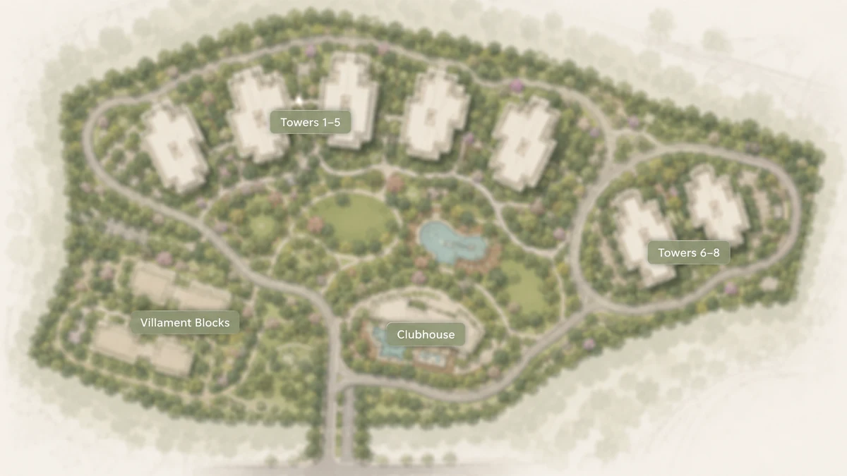
We have not seen a sanctioned plan, a layout drawing, a tower-numbering key, a phasing sequence, an entry-and-exit arrangement, tower footprints or block-to-block spacing, a configuration-wise split of the 1,304 flats, a clubhouse floor area, or a common-area loading factor. If a layout image reaches you for this parcel, note that there is currently nothing on the public record to check it against.
RERA status: this is a pre-launch scheme, and it is not registered
Embassy Sadahalli holds no registration with the Karnataka Real Estate Regulatory Authority, and there is no pending application on the register. Section 3 of the Real Estate (Regulation and Development) Act 2016 is direct about what that means: a project in a registrable class may not be advertised, marketed, booked or sold until registration has been granted. No booking may lawfully be taken here, no price is on offer, and no allotment can be made.
This site is an information and enquiry resource for a scheme at the approvals stage — it is not a booking channel, and we do not accept or forward money. When a registration is granted, the sanctioned plan and the unit-wise details will become public documents on the K-RERA portal, and that will be the moment a master plan can be discussed with numbers instead of gaps.
Embassy Sadahalli Master Plan FAQs
Why are there two environmental filings for the same land?
Because the second enlarges the first. The earlier filing, the one on which the Terms of Reference was granted, records 6.45 hectares — 15.94 acres — and a built-up area of 261,294.83 sq m. The current filing records 6.80 hectares, 16.80 acres, and 262,029.83 sq m. The signed ToR certificate prints a sixteen-number survey list; the current application form prints twenty, adding 129, 131, 132 and 134, and showing survey 150 as partial where the certificate showed it in full. Both records are real. We will not tell you that the four extra survey numbers "account for" the 0.35-hectare increase, because no document states an area per survey number, and one number moving from full to partial would subtract area rather than add it.
What is BIAAPA, and what has it approved?
BIAAPA is the Bengaluru International Airport Area Planning Authority, the statutory body that prepares and administers the Comprehensive Development Plan for the airport region. It is the planning authority for the land; the environmental track sits with the state environmental authority, and the two should not be confused with each other. What is on record is that Embassy's own application for this parcel states the site has been converted from agricultural to non-agricultural residential use under BIAAPA's Comprehensive Development Plan. That is a meaningful land-status fact and it is stated in the promoter's own filing. It is not the same as a sanctioned building plan, and we have not seen one.
How many towers will there be, and how can you state that so confidently?
Eight. Towers 1 to 5 form Building 1 and Towers 6 to 8 form Building 2. We state it plainly because, unusually for a project at this stage, the environmental filings themselves set out the tower count and the flat count within each building. Most pre-launch pages cannot honestly tell you how many towers a project will have, because the number is fixed only when building plans are sanctioned, and a page that quotes one is normally repeating a channel partner's guess. Here the number sits in a document lodged with a regulator by the promoter. It could still change if the scheme is redesigned before sanction, but today it is the promoter's own stated figure and not an inference.
How tall will the towers be?
The filings describe the apartment buildings with the configuration 3B + G + 14UF up to 3B + G + 20UF. Read in the filing's own notation, that is three basement levels, a ground floor, and between 14 and 20 upper floors, with the range covering the eight towers between them. What the filings do not do is say which tower stands at which height, so we cannot tell you whether the 20-storey blocks face the lake side or the road side, or how many towers sit at each height. The clubhouse and the villament buildings are filed at 2B + G + 3UF, which makes the villaments genuinely low-rise rather than a marketing description.
Which survey numbers does the land sit on, and is it converted?
The current application form lists twenty survey numbers in Navarathna Agrahara Village: 124(P), 129(P), 131(P), 132(P), 134(P), 136(P), 137(P), 138(P), 139(P), 140(P), 141(P), 142(P), 143(P), 144, 145(P), 146, 147, 148, 149(P) and 150(P). The signed ToR certificate for the earlier filing prints sixteen of these. On land status, the promoter's application states the site has been converted from agricultural to non-agricultural residential use under BIAAPA's Comprehensive Development Plan. On khata and property tax we have nothing to publish: the environmental filings do not record a khata number, a khata classification, or the parcel's current tax status. Ask for the khata extract and the latest tax paid receipt, survey number by survey number, and read them against this list.